Threats of arrest force hard decisions on Poso Creek, which could swamp two towns
Jack Mitchell’s phone is ringing off the hook these days, but he almost always picks up.
The head of the Deer Creek Storm Water District is busy coordinating crews and heavy equipment at multiple sites as he attempts to shepherd flood water from the Poso and Deer Creeks and White River along the edges of the old Tulare Lake bed.
But the caller early Monday wasn’t asking for a dozer. Instead, the person issued a warning: “We have papers drawn up and if you move the land plane or cut into the Homeland, you’ll immediately be arrested and thrown in jail,” Mitchell recalled.
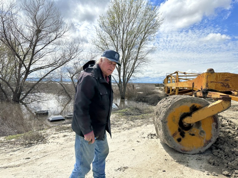
The “land plane” is a piece of heavy equipment that was dragged onto the banks of the Homeland Canal, owned by the J.G. Boswell company, at the southern edge of Tulare Lake to prevent a cut into the canal to drain flood water from Poso Creek.
This was the second time Mitchell had heard the threat so he wasn’t too rattled until he got a call later in the day from someone he says purported to represent the Kings County Board of Supervisors saying the same thing: leave the Homeland Canal alone or face jail.

“I asked him, ‘Well what do I do?’” Mitchell said. “‘Just let two towns flood to keep this water off the lakebed?’ And he just said that I should use my best judgment.”
A message from SJV Water to the number calling Mitchell’s phone was not returned. Likewise, a message to a Boswell representative Monday wasn’t returned.
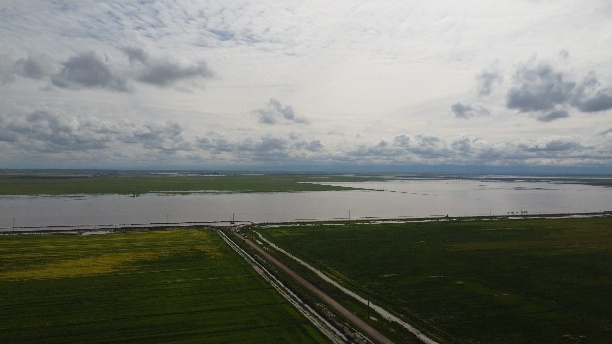
Sometime Sunday, the Boswell Company had also placed a pump to take water from the Poso Creek into the Homeland Canal. Mitchell estimated it could probably move 20 cubic feet per second. Poso is bringing about 1,000 cfs toward the lake bed, so the pump wouldn’t be much help.

Besides, “They ain’t even running it,” Mitchell said. Indeed, on Monday afternoon, the pump sat silent as the Poso water lapped the top of its channel, about 15 feet above water in the Homeland Canal and even higher above Boswell’s empty land to the north.
With no success getting anyone from Boswell to meet with him or even return calls, and the threat of jail hanging over his head, Mitchell opted to cut the Poso Creek channel further south and east from the Homeland canal to relieve the pressure.
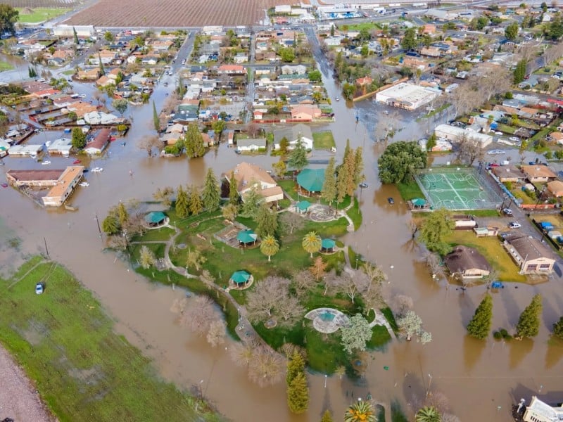
“But that’ll just give us another day. At most,” he said. Once Poso jumped its banks, he said, it would sweep east and north covering the tiny towns of Alpaugh and Allensworth.

Poso water had spread for more than five miles and was still building where crews of volunteers working with Mitchell had cut its channel at the end of Road 40, a few miles south of Alpaugh.
When Mitchell told them what he’d seen and heard about the Homeland Canal, the men couldn’t believe it. They repeated that the relief cuts they were making wouldn’t hold the water more than a day.
Already, the water was eating away at banks they had built using dirt, gravel and wrecked cars to keep it south of Alpaugh.
Mitchell spent the day driving along the Poso checking on crews and making calls to anyone he could think of, including the Governor’s Office of Emergency Services.
“I need someone with authority to help me get water into the Homeland Canal to keep it off these two towns,” he repeated several times to the Governor’s Office of Emergency Services where Dennis Smithson, assistant chief, said he’d check into the situation and call Mitchell back.
“I’m pleading, I’m begging you for help,” Mitchell said. Smithson said he’d call back.

Meanwhile, crews were still battling to close a hole that was intentionally cut in the banks of Deer Creek further to the north. Someone had illegally cut the banks in the middle of the night Friday or early Saturday morning, Mitchell said.
That water was initially headed toward Allensworth, but Mitchell predicted the flow would soon be staunched.
Rumors are rife as this slow motion tragedy continues to unfold.
One social media post implied Mitchell wasn’t working with landowners willing to take flood waters off of Deer Creek. But that’s not accurate, according to Mitchell.
Mitchell said he had heard from one farmer south of Avenue 56 who would take flood water but would need to cut a culvert into the 56, which trucks are using to deliver material to plug the hole in Deer Creek.
“I told him ‘Do not, under any circumstances, cut a groove in that road. We need that road,’” Mitchell said. “If there’s another landowner who wants flood water I haven’t heard from ‘em.”
For the time being, the Boswell Company is helping move Deer Creek water past Allensworth and Alpaugh by pumping it into the Homeland Canal.
Mitchell was grateful for the assist from Boswell, since groundwater pumping in the area had sunk areas to the north so Deer Creek can no longer follow gravity into the lakebed.

As all this has played out on the southern edge of the lakebed, the south fork of the Kings River and Tule River are pouring into the lakebed further north where the Kings County Board of Supervisors ordered a levee cut to let the water in.
So much of this would be alleviated if government agencies had taken an interest in the infrastructure of the area and bought land in the lakebed to take flood waters, Mitchell said.
This may be an “historic” event, but it’s not unprecedented.
As he explained to Smithson from the Office of Emergency Services, the Deer Creek district was created in 1908, two years after the region’s worst flood on record when Mitchell’s grandfather and other farmers battled the exact same rivers fighting their way into the old Tulare Lake bed.
“I’ve seen it before,” he said when asked how he knew which way the flood waters would go.