Kern River “orphan channel” could pose problems during the big melt

The Kern River flood channel that heads north to the old Tulare Lake bed from Highway 46 is decidedly not ready for what may become massive runoff.
It’s a thicket of trees and shrubs and its banks are a weedy, trash strewn mess.
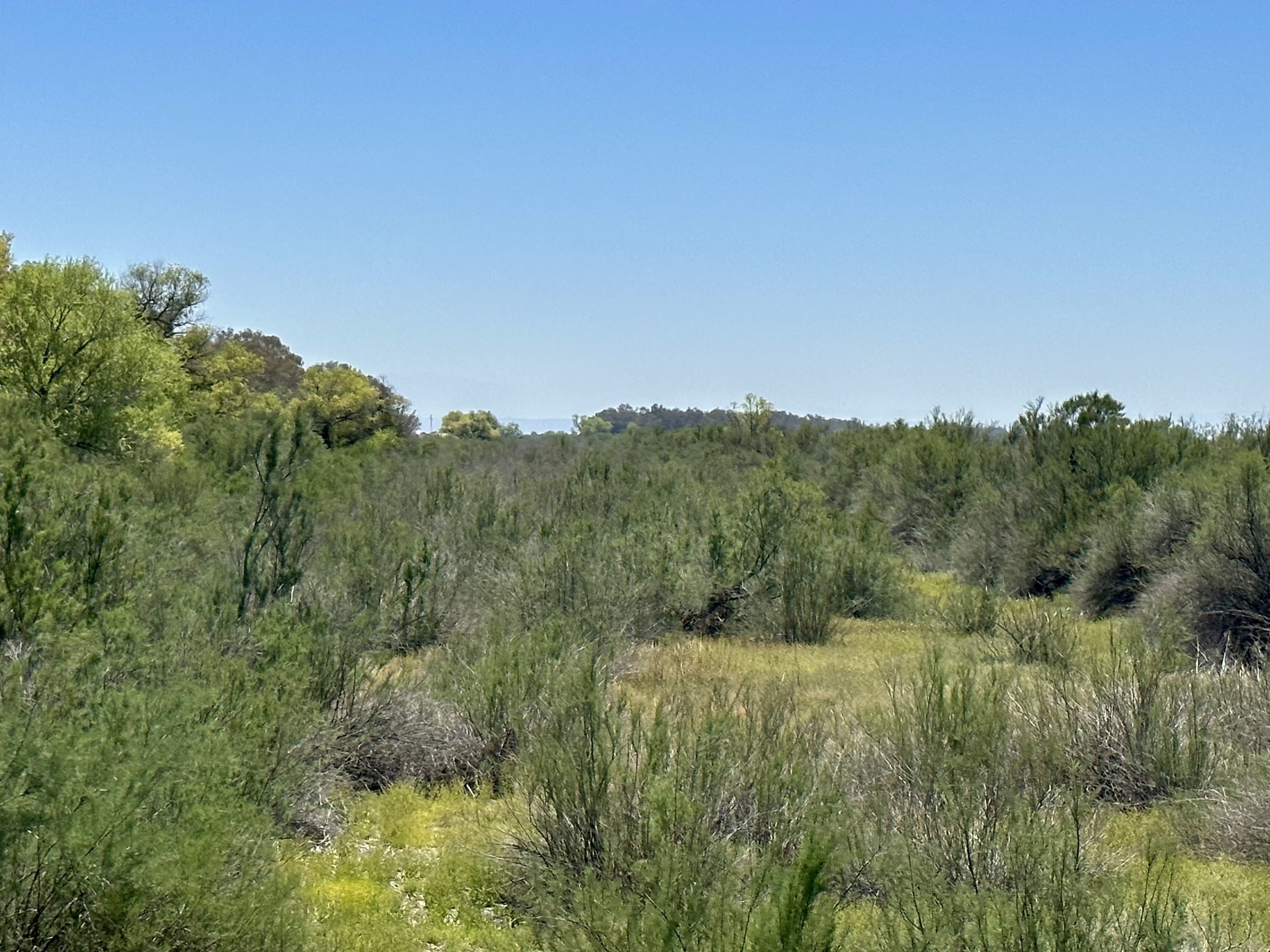
But figuring out who’s in charge of clearing out that 16-mile stretch river bed hasn’t been easy. It’s been so rarely used, the channel has become somewhat of an orphan with no agencies claiming responsibility for keeping it clear.
“Yeah, it’s a head scratcher,” said Kern River Watermaster Mark Mulkay, who’s been poring over old agreements and water rights documents for weeks to unravel the mystery. “I even had a call from the Kings County Sheriff’s Office asking about it.”
Spoiler alert: There is no agency in charge. At least none that would own up to it.
In the end, Mulkay let a handful of agencies that are most likely responsible know the situation and it’s up to them if they want to put some backhoes on cleanup detail.
It’s not a trivial issue.
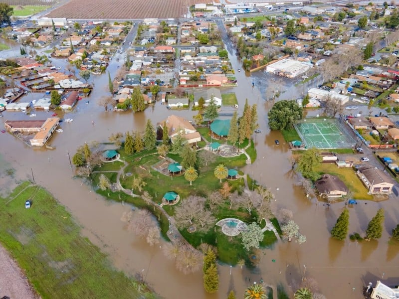
If the Kern River’s historic snowpack comes down faster than anticipated and overwhelms that channel, it could back up and break out its banks flooding homes, farms, roads and other important infrastructure, much as the Tule River did back in March.
That portion of the Kern River is rated by the Army Corps of Engineers to be able to carry at least 2,500 cubic feet per second. But there aren’t any regular inspections to make sure channel ratings are still viable and the Army Corps leaves maintenance to local agencies, according to an Army Corps spokesman.

So, who are those local agencies?
Buena Vista Water Storage District definitely has responsibility for the Kern River flood channel from about Enos Lane to just south of Highway 46, said General Manager Tim Ashlock.
North of 46 gets much more iffy.
“We’re not sure if BV is responsible,” Ashlock said. “Some documents seem to imply that.”
Delta Lands Reclamation District 770 and the Tulare Lake Basin Water Storage District also may have some responsibility, Ashlock and Mulkay said.
Both districts’ boundaries stop at the edge of the old Tulare Lake bed, short of the Kern River channel.
Regardless, Ashlock said he believed both districts, as well as the J.G. Boswell Company would work with Buena Vista to clear the channel.
Calls to the Tulare Lake district and Reclamation 770 were not returned. Boswell holds a majority of seats on the Tulare Lake district board and fully controls Reclamation 770.
The only other agency that may have some responsibility – though it denies that it does – is the Kern County Water Agency.
That’s because the agency bought what was known as the Hacienda water right back in 2000.
That is high flow Kern River water that, in big water years like this one, used to run all the way up to the Hacienda Ranch in the southern end of the old Tulare Lake bed.
But the agency has steadfastly pointed to Buena Vista, the Tulare Lake Basin water district and Reclamation 770 as the keepers of that last stretch of the Kern River.
While the channel passes through a variety of land owners, including the California Department of Fish and Wildlife, river channels, similar to canals, have separate ownership rights and responsibilities.
With flooding from the Tule and Kaweah rivers already causing major headaches on the Tulare Lake, no one would welcome more water from the Kern River.
“The goal is to keep it here in the county,” Mulkay said. “But a lot depends on Mother Nature and whether we get a hot spell.”

The Kern River watershed has a record breaking 1.8 million acre feet of water in its snowpack, according to the Department of Water Resources. Peak runoff is expected to bring 625,000 acre feet into Lake Isabella next month.
Considering the lake only has about 270,000 acre feet of room, that means a lot of water will be racing down the mountain – soon.
And Kings County water managers are watching, including Jack Mitchell, manager of the Deer Creek Stormwater District in charge of protecting the towns of Alpaugh and Allensworth along the southern edge of the old Tulare Lake.
“If they let the Kern River get out of control up here, that’s gonna be a big sonofabitch.”