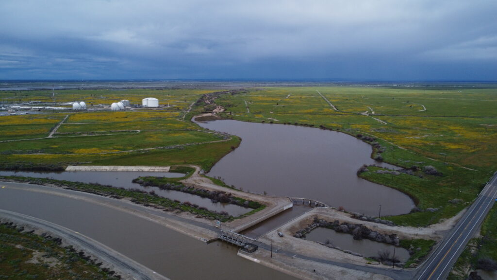
Kern River water is expected to go into the intertie, which connects the river to the California Aqueduct, starting Saturday morning.
The goal is to keep more flood water from reaching the already flooded Tulare Lake bed in Kings County.
The plan had been to begin dumping Kern River water at 500 cubic feet per second through the intertie starting Monday, May 15 and go up from there to 1,000 cfs. But that was delayed by several days as various government entities conferred about protocol and a possible need for water rights permits.
An executive order issued by Gov. Newsom’s office Wednesday evening cleared the way, exempting the move from permits.
The delay did allow some Kern River water to head north. About 200 cfs was seen flowing in the Kern River flood channel headed to Tulare Lake about five miles north of Highway 46, said Kern River Watermaster Mark Mulkay.
“I don’t know how far it got though,” he added.
He had been hopeful late last month that there would be no need to use the intertie and all Kern River water could be kept in the county.
“Then the heat ramped up and we got a better look at snow conditions on the ground,” he said. “We’ll be taking things week by week.”
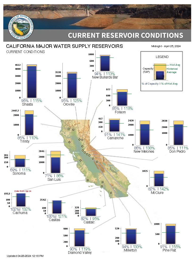
The Army Corps announced on May 9 that the agency anticipated Lake Isabella would fill beyond its maximum capacity to 658,262 and that water would come over the dam’s regular service spillway.
“There is no expectation that water levels will reach the top of the new labyrinth weir or spill into the emergency spillway,” the Army Corps announcement states.

Releases from the dam were expected to be at “or above designated channel capacity levels,” the announcement adds.
Outflows from Isabella were at 7,271 cfs Thursday afternoon and expected to go to 7,500 cfs in an attempt to make enough room in the lake for runoff from the massive snowpack, estimated to hold 1.8 million acre feet – more than three times the amount Lake Isabella can hold.
Projections from the Department of Water Resources show river outflows could go above 9,200 cfs for a short time in mid-June. At that level, low lying areas east from Manor Street east could see flooding, according to new maps issued by Kern County.
Areas within the City of Bakersfield have less chance of flooding thanks to a system of levees and canal banks and there’s much less water coming through the river channel as much of it is taken off by a network of canals.