A massive effort – restoring the San Joaquin River
November 22, 2022
Jesse Vad, SJV Water
• by Jesse Vad, SJV Water
A fish skeleton lies on the ground by a structure near the San Joaquin River designed to protect against flooding. The structure also impedes fish migration up the river and will be altered as part of the San Joaquin River Restoration Program. Jesse Vad / SJV Water
Jesse Vad, SJV Water
RIVER MAP
CLICK HERE for an interactive map describing the San Joaquin River Restoration Program section by section.
Share This:
The San Joaquin River is a vital source of water for agriculture and the environment and it is also home to a unique program that hopes to restore native fish runs.
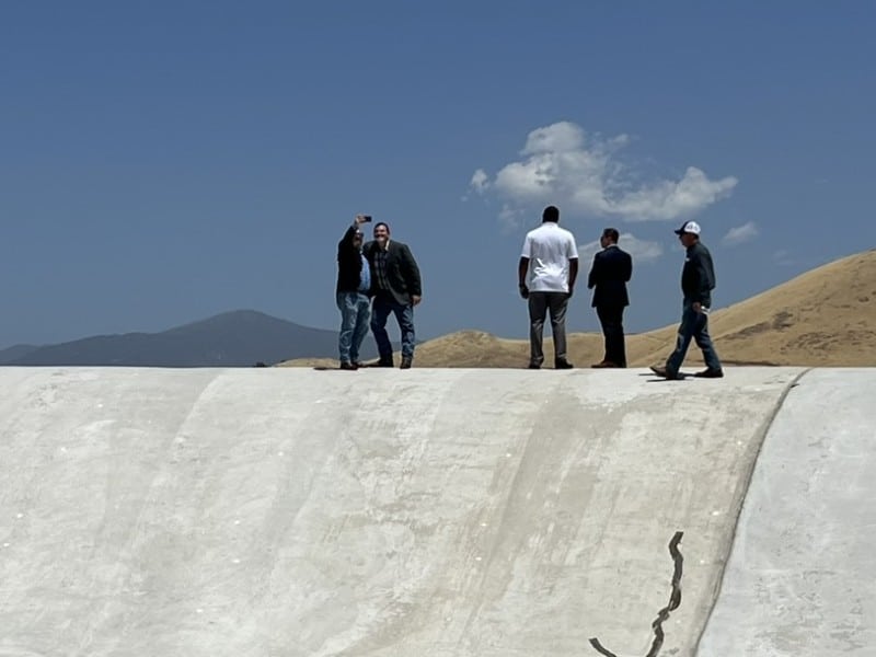
It is a complex program and SJV Water was fortunate to take advantage of a tour offered through the Water Education Foundation Nov. 2-3 that helps break down the various aspects of restoration efforts.
The restoration program is a nearly one billion dollar endeavor to restore spring-run Chinook salmon to the river which went extinct there after Friant Dam and other obstructions were built.
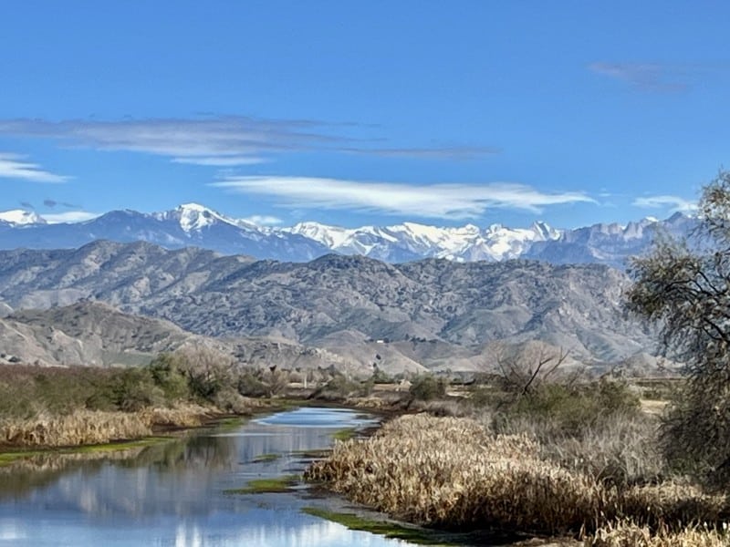
The 366-mile-long San Joaquin River starts high in the Sierra Nevada mountains east of Fresno. It travels north through the valley to the Sacramento-San Joaquin Delta and, ultimately, flows into the San Francisco Bay. Historically, the river was home to many runs of salmon, including spring-run Chinook which made up a significant portion of California’s commercial fishing industry.
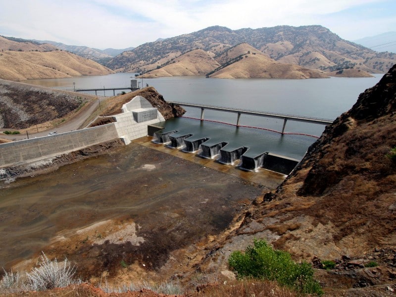
In the 1940s, the Friant Dam was built by the federal Bureau of Reclamation above Fresno and most of the river’s water was routed south to farms and towns all the way to Arvin via the Friant-Kern Canal. The river was dried up for more than 60 miles until its confluence with the Merced River.
In 1988, the Natural Resources Defense Council, along with other environmental groups, sued the federal government to restore the river and the salmon populations. After 18 years, the case was settled in 2006. That led to creation of the Bureau’s Restoration Program, tasked with restoring salmon populations.
The program was able to reconnect the river for the first time in 2016 but progress has been slowed by recurring drought and unanticipated costs due to water seepage damage to farmland adjacent to the river.
Participants on the recent tour heard from a wide range of experts and stakeholders during the tour, including scientists, state engineers, farmers and water district managers.
CLICK images for larger view:
The San Joaquin River Restoration Program divides the river into sections – or “reaches” that each have unique challenges to the goal of restoring a spring-run of Chinook salmon.
Friant Dam, the first stop on the San Joaquin River tour. Behind the dam is Millerton Lake, the reservoir that provides Friant Water Authority users with water, when they receive an allocation. This year, Friant contractors received 15% of their full allocation. But across the valley on the west side, the San Joaquin River Exchange Contractors Water Authority were entitled to 100% of its 600,000 acre feet allocation. The Exchange Contractors are four agricultural water districts that extend from Newman down to Firebaugh on the west side of the valley. When the federal government built the Central Valley Project in the 1930s, it took San Joaquin River water from existing water users and moved it to Friant contractors in the southern part of the valley. In “exchange,” the federal government promised the original river users water from the Sacramento-San Joaquin Delta. That promise carries on today and the Exchange Contractors have a strong entitlement to water based on their government contract. But because there wasn’t enough water in the delta to fulfill the Exchange Contractors’ allocation, the Bureau of Reclamation turned to Millerton Lake and took some water from the reservoir down the river to the Exchange Contractors. It’s a situation that happened before in 2014-2015, much to the dismay of Friant water users. Friant Water Authority also has to pay for 40% of the Exchange Contractors’ pumping and transport costs, said Alexandra Biering, government affairs and communications manager for Friant Water Authority. “It was a painful year,” added Biering.
A view of Millerton Lake from atop Friant Dam.
Skaggs Bridge Park, one of the early stops downriver from Friant Dam. Here, the tour met with 92-year old retired farmer Walter Shubin, who grew up in the area and talked about what the river used to be like in the days before agriculture dominated the landscape and the watershed.
92-year old retired farmer Walter Shubin speaks to the group on the banks of the San Joaquin River at Skaggs Bridge Park. Shubin reminisced about growing up here. Then, the river was a couple football fields wide, he said. Shubin remembers seeing salmon going up the river in the thousands. There were so many, as a kid he thought he could run across the river on the backs of the fish without ever touching the water. Shubin was one of the few area farmers who publicly advocated for the restoration program, incurring the enmity of many of his fellow farmers.
Stormy skies north of the Chowchilla Bypass and Bifurcation Control Structure.
The Chowchilla Bypass and Bifurcation Control Structure. This structure controls river water when floods hit. The ground throughout the San Joaquin Valley has been subsiding (sinking) because of groundwater overpumping in agriculture. This area has been particularly hard hit by subsidence which is putting the flood system at risk as levees sink. The bifurcation gates are a barrier for fish. But the restoration program is focused on more major impasses first and will address this structure later. This is an unfunded project that will be part of Stage 2 of the restoration program. The last time there was water in the bypass was 2019.
The San Joaquin River at the Chowchilla Bypass and Bifurcation Control Structure
Shane Swartz, general manager of the Lower San Joaquin Levee District, talks to the group about flood control operations at the Chowchilla Bypass and Bifurcation Control Structure. The district operates, maintains and repairs levees, bypasses, flood control structures and other facilities of the Lower San Joaquin River Flood Control Project, which was created to protect the region from flooding along the river.
Presenters and tour participants gather at the Mendota Dam, overlooking the Mendota Pool which sits at the intersection of the San Joaquin and Kings rivers. The pool is a diversion point for irrigation water that comes down from the delta through the Delta-Mendota Canal. The dam is a major impediment for fish. The program is planning a project which will cut a channel to bypass the Mendota Pool so that fish can migrate around it. Adult salmon returning from the ocean can’t get past the dam. And juvenile fish going downstream are subjected to unusually high predation here because the dam has raised water levels and led to slow moving waters.
A view of Sack Dam, one of the other major impediments to fish on the river. Here, the restoration program is planning another passage project. The program will build a fish passage around the dam and install a fish screen over a canal opening to keep fish in the river. The design is currently at 30% and the estimated cost is $40 million.
Emily Thomas, Sack Dam project
A view from the Eastside Bypass Control Structure, another flood control facility.
Dead fish behind the Eastside Bypass Control Structure. T
Another view of the Eastside Bypass Control Structure. This structure will be modified for fish passage. There will be a low flow channel designed here and some parts of the structure will be removed. A rock design will also be placed downstream of the structure.
Dead fish trapped behind the Eastside Control Structure.
A fish skeleton lies on the ground by a structure near the San Joaquin River designed to protect against flooding. The structure also impedes fish migration up the river and will be altered as part of the San Joaquin River Restoration Program. Jesse Vad / SJV Water
SJV Water is an independent, nonprofit news site dedicated to covering water in the San Joaquin Valley. Get inside access to SJV Water by becoming a member.
You must be logged in to post a comment.