
Editors note: This story is a collaboration between SJV Water and Fresnoland, a non-profit news site in Fresno.
Contributing reporters
Jesse Vad, SJV Water, jesse.vad@sjvwater.org
Gregory Weaver, Fresnoland, gregory@fresnoland.org
Shaikh Rashad, Fresnoland, omar@fresnoland.org
Residents and agencies struggle with jurisdiction in historic flood fight near the old Tulare Lake bed
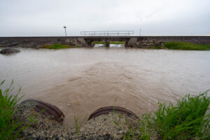
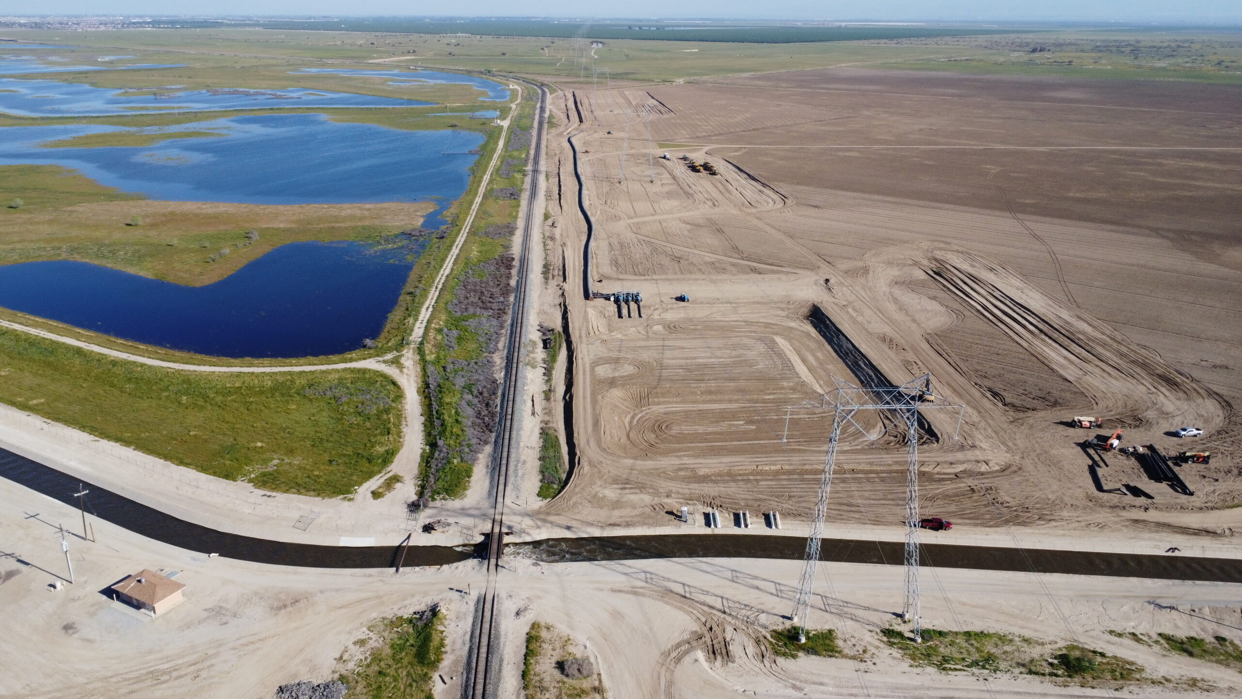
Flood water flowing toward the small town of Allensworth from the White River had been looked over by everyone from the local stormwater manager to the very head of water resources in the state of California for more than a month.
They all agreed it was a problem.
The water could have been blocked from the west where it rushed under railroad tracks owned by Burlington Northern Santa Fe. If the water were turned north, instead, it would no longer be a problem for little Allensworth, according to Jack Mitchell, head of the Deer Creek Storm Water District, which includes the community.
Yet, no one was able to make that happen, not even Mitchell.
It’s a jurisdiction thing.
Mitchell’s authority doesn’t extend to property owned by the railroad, he said. He had to get permission from BNSF and then another landowner to block the water and move it north along Highway 43.
“I’ve been jumpin’ through all these hoops,” Mitchell said.
And there is no higher authority that could have taken over to get it done.

That’s because in the southern San Joaquin Valley, there is no overarching flood control agency.
When it floods in the south valley, water is “managed” by a patchwork of different agencies with a variety of boundaries, authorities and purposes.
They try to work together, but flooding that started with the March 10 storm revealed serious gaps in the system.
The record-breaking snowpack looming over the valley promises to test the valley’s fragmented flood response even more as the melt gets underway, prompting the question: Who’s in charge?
Patchwork response
In the fragmented system of the southern valley, it’s up to the county governments to act as the glue between the patchwork of different agencies, said Karla Nemeth, director of the state Department of Water Resources (DWR).
“The patchwork is not uncommon in flood. But what is different about the Tulare basin is the lack of regional joint powers authorities that exist in other parts of the state,” said Nemeth.
Other parts of the state are better prepared because of those overarching authorities, she added.
Such an authority could help responders better access even the most basic information, such as where levees are located and who owns and maintains them.
In Tulare County, officials don’t know where all the levees are or whether they’re certified by the Federal Emergency Management Agency, according to the county’s 2018 hazard mitigation plan and Denise England, with Tulare County’s Resource Management Agency.
Maintaining levees is a whole other patchwork story.
In Kings County, for instance, some levees are maintained by the Kings River Conservation District south of Highway 43.
“But north of the 43, that’s up to the counties, whether they are going to maintain and operate the levees and channels,” said Randy Macfarland, a consultant for the Kings River Water Association.
And that may not be something counties have authority to do, England said.
“Ultimately, a lot of things that need to happen probably aren’t going to be within the county’s jurisdiction,” England added.
Levee discord
The lack of a coordinated approach to levee management created chaos on the Tule River, where farmers and dairymen took matters into their own hands, building their own levees and using excavators to clear debris out of the channels, which contributed to erosion.
In the Tulare Lake bed, Kings County supervisors have made decisions in closed session about which levees to cut, in order to relieve flooding in hard-hit communities – in absence of a publicly vetted plan on which land should flood first.
Though Macfarland said the Army Corps of Engineers, which owns and operates dams on the Kings, Kaweah, Tule and Kern rivers, also holds sway over levees in the southern San Joaquin Valley, the Army Corps said that’s not their responsibility.
“Our authority is pretty clear cut. Our authority includes those flood control dams that we own and operate in, and that’s it,” said Rick Brown, chief of public affairs for the Army Corps.
“We do not own or operate any of the levees in [the Tulare watershed]. So, we have no call over how those would work directly.”
DWR can request the Army Corps to inspect existing flood protection projects but that requires a whole chain of sign-on from local water districts and the county, Brown said.
Collaboration works, but is rare
Flood control collaborations between cities and flood agencies are scarce in the Tulare Basin.
Dan Vink, chairman of the Tulare County Flood Commission, helped forge one of the few that exist.
In the late 1990s, as the Army Corps planned an expansion of Lake Success’ Schafer Dam, Vink brokered a joint powers agreement with the city of Porterville to bolster flood protection around the city.
The agreement established an annual work plan with the county and the Lower Tule Irrigation District to expand flood channels and keep them clean and operational.
That effort panned out this winter, he said.
Porterville stayed largely dry, even though, at its peak, the Tule River was running 200% above the city’s flood channel capacity.
“That work is a major reason why the city didn’t flood,” Vink said. “For all the problems that we have right now, one thing that we didn’t have is any significant flooding around Porterville. I think that’s a direct connection to the two decades of work that have been going on.”
But such agreements seem to be a rarity in the Tulare basin, Vink said.
“I’ve not seen it replicated anywhere else, at least in the Tri-County area (Kings, Tulare and Fresno County).”
Outside the boundaries
After the March 10 storm, entire neighborhoods in Woodlake took multiple feet of water. Nearly 40 homes were damaged and some residents lost everything.
Families are still displaced because of the flooding and residents are looking at tens of thousands of dollars in repairs for their homes.
Having a flood control district or a more centralized system could have potentially helped, said Ramon Lara, city administrator for Woodlake.
But there was so much water there likely would have been damage no matter what, he added.
Still, the lack of centralized oversight was felt by the city.
It was up to six members of the Public Works department to clear ditches, creeks and other infrastructure, said Lara.
Coordination with other agencies was mixed.
“There’s not a lot of great planning, not a lot of communication that I think there needs to be,” Lara said. “That’s why we’d be interested in being in some sort of joint commission, so we’re better prepared in the future.” 
For the small city of Woodlake, there is no local flood control district, or any agency responsible for overseeing the area when it comes to emergency flood situations. That responsibility falls wholly on the city.
Directly to the south of Woodlake is the Kaweah Delta Water Conservation District, which oversees flood operations and water infrastructure for 340,000 acres stretching to east of Corcoran. It provides flood protection for the cities of Visalia, Tulare, and Farmersville.
When the district was formed in 1927, the boundaries were never set to include Woodlake, said Shane Smith, general manager of Kaweah Delta.
“I’m not sure exactly why the city of Woodlake is not in the boundaries, “said Smith.” “That was way before my time.”
And when it comes to expanding the boundaries to include Woodlake, Smith said he doesn’t know that there is interest to do that.
Uncontrolled streams
While the region’s major rivers, the Kings, Kaweah, Tule and Kern have at least a patchwork of oversight, there is little to no oversight of so-called “uncontrolled” streams, or streams that aren’t dammed.
That includes Lewis Creek, a foothill stream on the outskirts of Lindsay, about 10 miles north of Porterville, which breached its banks and flooded 23 homes after the March 10 storm.
Flooding caused $1 million in damage to private property and another $780,000 to public property, per city officials.
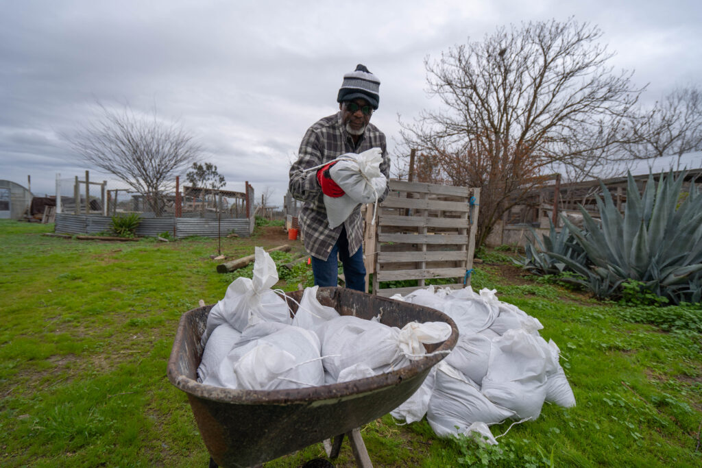
City Manager Joseph Tanner was proud of how residents and city staff came together during the flood. At least 100 residents volunteered to shovel, pack and distribute sandbags, he said.
“We had the high school football team out there one day, shoveling bags. It’s really been nice to see,” he said.
Lewis Creek likely breached its banks because the channel hadn’t been properly maintained, Tanner said.
But the city can’t take over to make sure it doesn’t overflow again because that section of the creek is outside of city limits.
Agencies in place need help, money
Those flood and water agencies that do exist across the Tulare Basin could coordinate with cities and between the four counties to create a regional flood plan, Vink said.
But they need money to build the system. Levees need to be fortified, and natural floodplains need to be expanded, he added.
To coordinate across local agencies and with private landowners, the Tulare basin needs an authority “that’s pretty light on its feet, like a task force,” Vink said.
“Absolutely, at a bare minimum, we need some kind of coalition to address it on a fairly wide basis. I think that would be an ideal solution,” said Steve Haugen, director of the Kings River Water Association.
“Every time you come out of a crisis, there’s opportunity. And I think there’s a real opportunity here. I would take a hard look at a long-term approach of creating more floodplains,” Vink said.
But that will take significant funding, he said.
The Legislature had approved $40 million for flood plain projects in the valley in this year’s budget. But the Newsom administration axed that funding in January.
Other flood districts, such as Fresno Metropolitan Flood Control District, which covers the Fresno and Clovis urban area, use a combination of parcel taxes and developer fees to help leverage state and federal bond funding to pay for larger flood control projects.
But that’s a more difficult option for smaller, rural communities that aren’t seeing a lot of growth, especially as funding agencies tend to prioritize areas with larger populations.
“We’re trying to protect our rural and small communities, and that really doesn’t measure up when you’re up against a Fresno Metropolitan Flood Control District, that’s protecting a large metropolitan area,” explained Tulare County’s England.
Ready for the big melt?
As water recedes in some areas from the first flush of flooding brought by March storms, questions linger about how the south valley’s patchwork approach will handle the coming runoff from an historic snowpack hovering in the mountains.
There is a state level flood agency that oversees some parts of the valley. But the Central Valley Flood Protection Board doesn’t include south valley counties and river systems. There’s debate about why that is. Some say south valley water managers didn’t want to give up local control over area rivers.
Either way, DWR chief Karla Nemeth alluded to the possibility that if local flood responses weren’t up to handling the spring runoff, the state could possibly step in.
“We are looking into the (Central Valley Flood Protection) board’s authorities right now,” she told SJV Water in March. “We do believe it does have the authority to identify appropriate places for flood waters in the event of extensive flooding.”
In the long term, others have said county agencies called Local Agency Formation Commissions could, and should, step in.
Critics argue the agencies could define flood response boundaries and authorities so gaps could be filled before levees break and residents are caught unprepared.

You must be logged in to post a comment.